This Airport Has Runways Longer Than Most Major Hubs – But Pilots Can Only Reach It By Eye
Skardu Airport (KDU) in Pakistan's Gilgit-Baltistan region presents one of the most operationally demanding combinations in commercial aviation: runways long enough to accommodate narrowbody jets, yet an environment so hostile that crews must rely primarily on visual references and precise energy management just to complete a safe arrival. Situated at 7,316 feet MSL within the Karakoram range — surrounded by terrain rising to nearly 19,000 feet — KDU's main runway stretches 11,944 feet, exceeding the runway length at many European regional hubs and routinely handling Pakistan International Airlines A320 and B737 operations. That apparent generosity in pavement, however, offers false comfort. The real challenge begins well before the flare: aircraft must thread through confined valley corridors from Gilgit with mountains hemming both sides for extended portions of the arrival, making any deviation from prescribed routing potentially unsurvivable.
The "Zulu bend" — the sharp, visually-referenced final turn that defines the KDU approach — is what separates this airport from most high-altitude destinations. Rather than tracking a precision instrument glide path with lateral and vertical guidance, crews executing this maneuver must integrate terrain awareness, airspeed control, descent rate management, and configuration changes simultaneously in a compressed geographic space. The penalty for poor energy management is asymmetric: carry too much speed and runway alignment becomes problematic; descend too aggressively and terrain clearance margins evaporate. Pilots transitioning from high enroute altitudes into the valley environment must shed energy quickly without sacrificing safe obstacle clearance, a task the article correctly compares to tactical military terrain flying rather than standard line operations. For commercial crews, this represents a meaningful departure from the instrument-guided, highly proceduralized environment that defines nearly all modern airline flying.
The airport's performance environment compounds these approach challenges in ways directly relevant to any operator considering high-elevation or mountainous-destination flying. At over 7,000 feet MSL, density altitude is elevated before temperature is even factored in. During summer months, the combination of heat and elevation — the "hot and high" condition — can push effective density altitude considerably higher, reducing both engine thrust output and aerodynamic lift generation. Takeoff rolls lengthen, climb gradients flatten, and obstacle clearance requirements tighten. For weight-and-balance planning purposes, crews operating into KDU must calculate payload restrictions more conservatively than they would at sea-level airports with identical runway lengths. The long runway provides a buffer, but not an unlimited one, and operators who conflate available runway footage with unrestricted performance are courting a serious miscalculation.
Perhaps most notable from a regulatory and procedural standpoint is that KDU continues to operate predominantly under Visual Flight Rules in an era when instrument approaches have become standard at virtually every commercial airport of comparable traffic volume. This VFR dependency creates a hard ceiling on operational utility: visibility minimums, cloud bases, and mountain obscuration directly govern whether the airport is usable on any given day, regardless of aircraft capability. For airline planners and charter operators considering KDU, this translates into meaningful schedule reliability risk and contingency fuel requirements, since holding or diverting around Karakoram terrain is not a low-consequence event. The absence of precision approach infrastructure — despite the airport handling mainline jet equipment — reflects the broader infrastructure gap that characterizes high-altitude remote airports across South and Central Asia, where terrain and geography have outpaced investment in navigation aids.
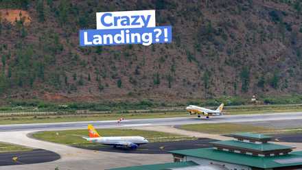
Skardu's growing visibility through cockpit video content online illustrates a wider trend in aviation media: technically demanding operations that were once known only within specialist pilot communities are now reaching broad public audiences, generating both enthusiasm and, in some cases, misplaced assumptions about the difficulty of such flying. For professional pilots, the airport serves as a useful case study in why raw runway data is an incomplete metric for evaluating operational complexity, and why visual flying skills, terrain awareness, and density altitude proficiency remain essential competencies even as the industry pushes toward increasingly automated, instrument-dependent operations. Airports like KDU, Paro, and Innsbruck exist as reminders that geography has not been fully engineered out of the equation.







 Read original article